When we last saw our intrepid travelers, they had just finished decoding part of a map inside Shinjuku station. They decided it was time to go out and explore the neighbourhood[1].
As they ventured onto the back streets, away from the bustle of the station, one of the first things they noticed was maps that looked like this:
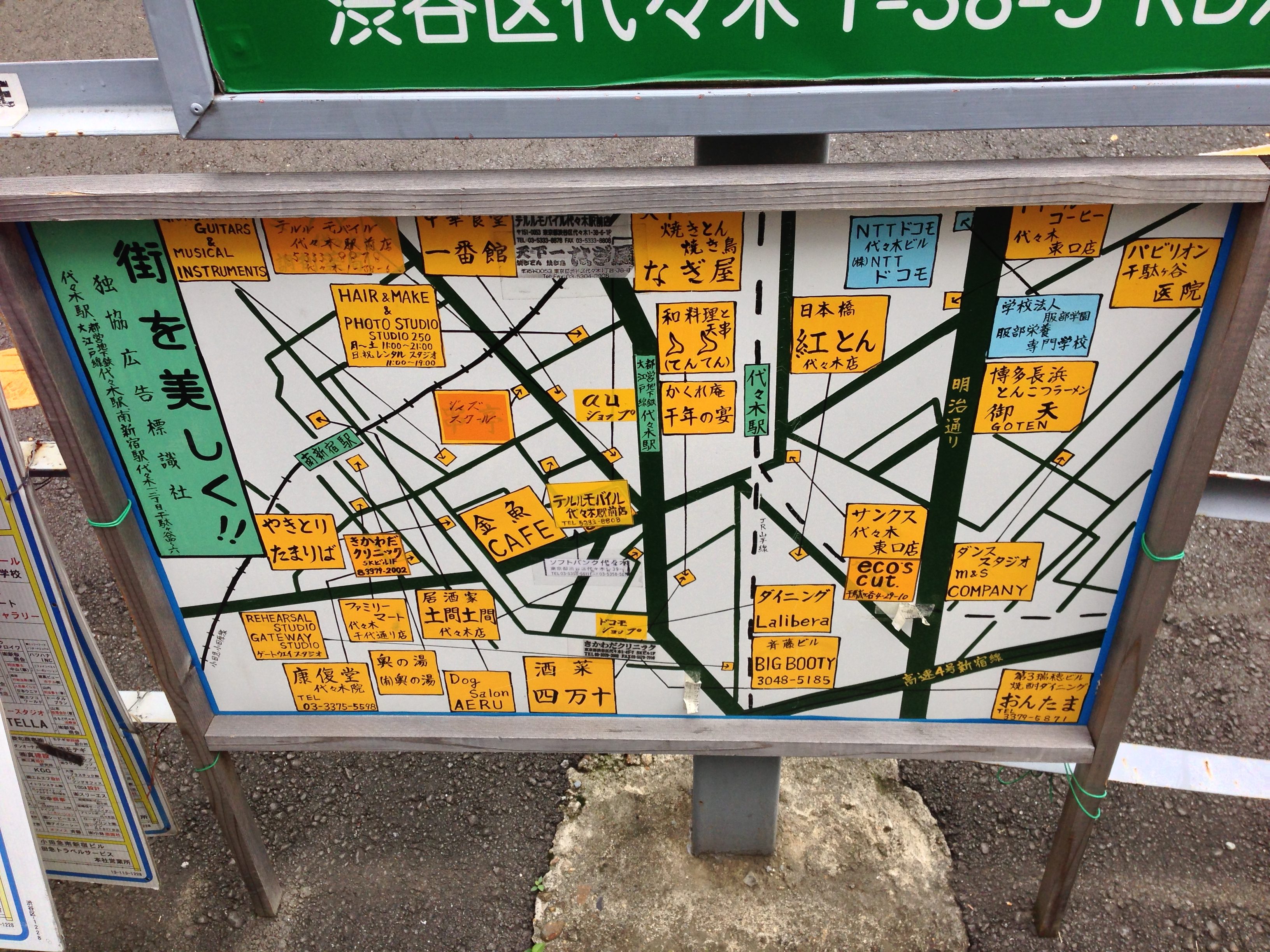
As you can see, this is a map showing where various commercial establishments are in the neighbourhood. (The specific neighbourhood seems to be between Minami Shinjuku and Yoyogi Stations.)
The green label on the top looks like it reads “ShiBuYa (ward in Tokyo) YoYoGi (neighbourhood in Shibuya ward) T-38-3 RD7″.
The large green label on the left reads: “MaChi Wo Mi ShiKu!!” or “Town/Neighbourhood (of) Beauty District”.
This would make sense, given the prominent advertisement for ‘Hair & Make & Photo Studio”. There seem to be a number of restaurants, such as the ‘YaKiToRi ToMaRiBa’ (or Yakitoi Haunt)
There are a number of things I can’t decipher, such as: “FuaMiRi- Ma-To”, and “(TeNTeN)”, which might be a cool bar with a difficult-to-search name, or perhaps an eyebrow salon.
“TeRuRuMoBaIRu”, possibly a mobile phone store, but also turned up this in a google search.
There’s also “SaNKuSa YoYoGi …” “Sankusa Yoyogi bundle opening store” But ‘Sankusa’ is in Katakana, meaning it’s a loan word from somewhere, Yoyogi is the neighbourhood, and the last three words seem to be describing it as some sort of store. If we were there, it would probably be easy to find out. 🙂
The last one is in the lower right corner: “DaNSu SuTaJhiO M&S Company”, which sounds like a Dance Studio! 🙂
The previous map and the next map were beside one another on the street, suggesting that they referred to the same or similar neighbourhoods. At the time, we had figured that these maps were some sort of neighbourhood directory, but I had thought that the one above was commercial, and the one below was residential.
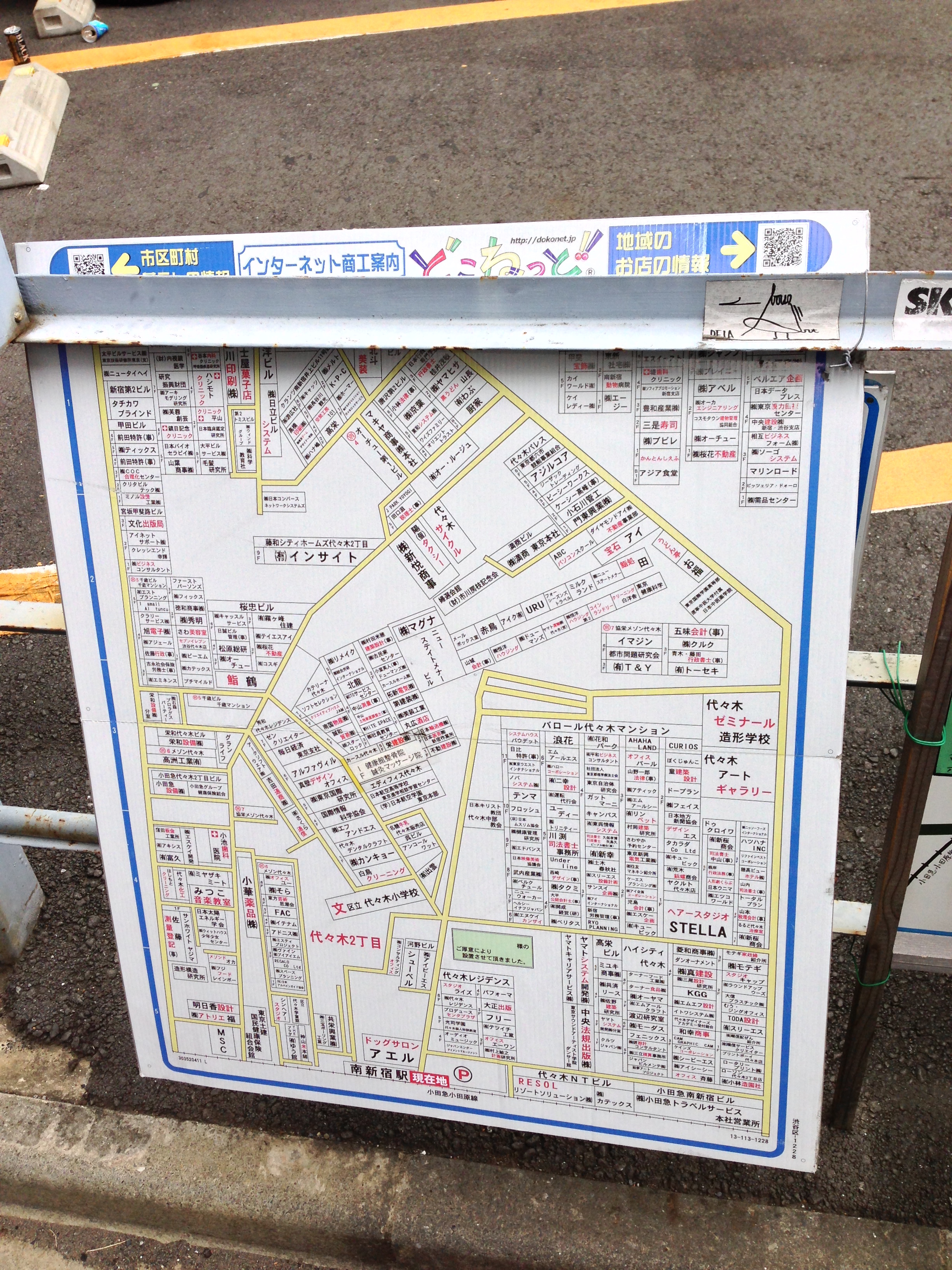
At the top, in blue on white, it seems to say “INTa-NeTo”, beside a ‘DoKoNeTo’ ad, suggesting it’s an internet company ad. Beside it is a pointer to a QR code, which I will ignore, because QR codes are silly.
Looking at some random establishments, we see:
– “INSaITo”
– “MaGuNa” (The smaller characters are difficult to read, perhaps SuChiIToANa-?)
– “Yoyogi ZeMiNa-Ru”, “Yoyogi Seminars”? beside:
– “Yoyogi A-To GiyaRaRi-” Which seems to be ‘Yoyogi Art Gallery”
– Beside what looks like a large building titled “BaRo-Ru Yoyogi MaNShiyoN” or “(something) Mansion Yoyogi”, which has such establishments as:
– “AHAHA LAND”
– “TeNMa”
– “HeA-SuTaNO” (Perhaps ‘Suntan’ or spa?)
– …
And many others I can’t make out. How many can you find/translate?
This next map seemed somewhat the worse for wear:
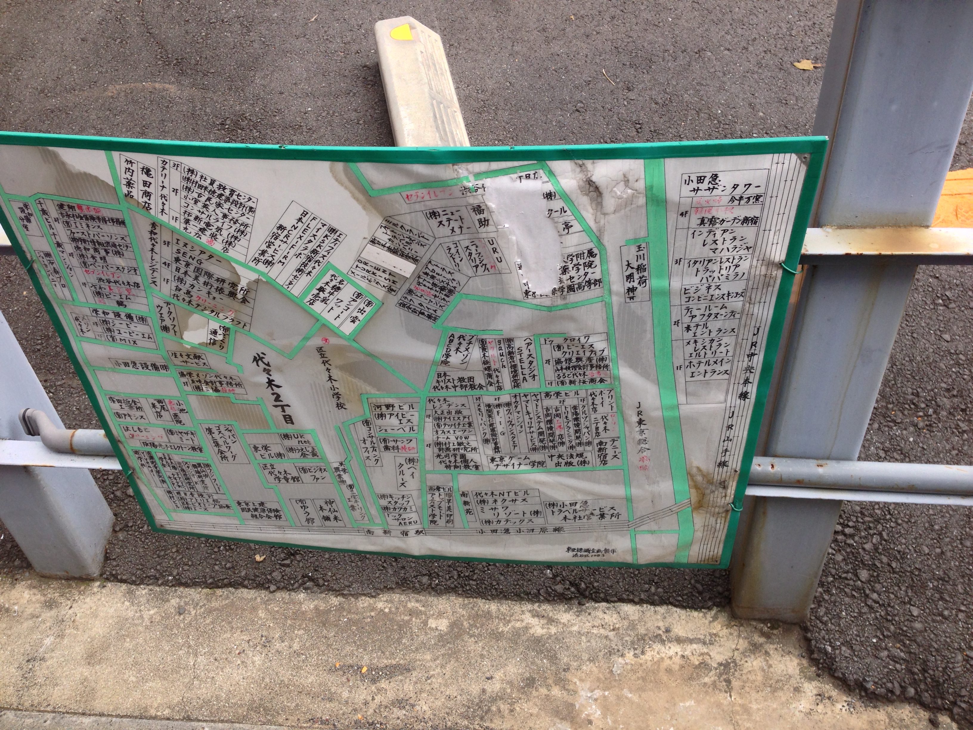
I can’t make out too many words in this one, perhaps a ‘KuRi-Su’, there’s a JR station on the right side of the map, ‘SaSaNiTaWa-‘, and many others I can decipher even less about.
What can you figure out? I feel like this has helped me with a lot of Katakana practice (and Yoyogi-recognition practice), but I still have a long way to go. It’s also interesting to see how many different neighbourhoods that we had heard of were so accessible to each other, often just by walking at random.
Stay tuned for next time, when our intrepid travelers, now that they’re oriented themselves, start actually experiencing the city!
[1]Some of their explorations from that first day, related to the design of the city and various objects, were captured earlier in ‘Thoughts on Design in Japan‘.